IMPACTS OF RESEARCH ACTIVITIES
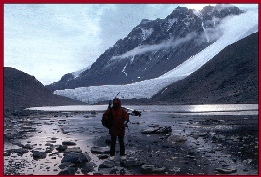
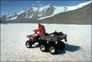
Researcher at Lake Chad in Taylor Valley with Seuss Glacier and 2000 m-high mountains in the background.
McMurdo Dry Valley Lakes: Impacts of Research Activities
Report of a National Science Foundation Workshop held at the University of Illinois at Chicago 15 - 17 July 1998
|
R.A. Wharton, Jr., Editor Desert Research Institute University and Community College System of Nevada Reno, Nevada 89512 USA |
|
P.T. Doran, Editor University of Illinois at Chicago Chicago, Illinois 60607-7059 USA |
This document should be cited as Wharton, R.A., Jr. and P.T. Doran (eds.) 1999. McMurdo Dry Valley Lakes: Impacts of Research Activities. Desert Research Institute, University and Community College System of Nevada, USA, special publication, 54 p.
Additional copies of this document may be obtained from the Desert Research Institute.
Cover photograph: Researcher at Lake Chad in Taylor Valley with Seuss Glacier and 2000 m-high mountains in the background.
| Executive Summary ...................................................................................... | 1 |
| Preface........................................................................................................... | 3 |
1. Introduction .............................................................................................
|
6 8 |
2. Impacts Common Throughout the Valleys .............................................
|
13
13
|
3. Impacts Unique to Basin Activities.........................................................
|
22
22
|
4. Impacts From Lake Research..................................................................
|
29
29
|
| 5. Conclusions and Recommendations........................................................ | 38 |
| 6. References ......................................................................................... | 42 |
| Appendices | |
| Appendix 1: Workshop Participants......................................................... | 46 |
| Appendix 2: Environmental Code of Conduct for Field Work in the McMurdo Dry Valleys............................................... | 50 |
| Photo Credits: ......................................................................................... | 54 |

The lakes of the McMurdo Dry Valleys (latitude 77-78.5� S; longitude 160-164.5� E) in southern Victoria Land, Antarctica represent a unique subset of lakes on Earth. The Dry Valley lakes are perennially ice covered, exist mostly in closed basins, and are biologically dominated by microorganisms. Given the uniqueness and high scientific profile of the Dry Valley lakes, there is great interest in preserving their pristine nature. In the process of conducting research on the lakes and their watersheds, significant and potentially irreversible impacts may be occurring. However, a quantifiable understanding of the impacts of camps, surface travel, and the various observational, experimental, and manipulative approaches to studying the Dry Valley lakes is not available.
In July 1998, a workshop sponsored by the National Science Foundation was held at the University of Illinois at Chicago to identify potential lake impacts from research activities and suggest possible management approaches designed to minimize these impacts. The 35 participants came from five countries representing a variety of disciplines and Antarctic experiences, as well as limnologists with global scale perspectives.
The workshop participants suggested that individuals visiting and working in the McMurdo Dry Valleys recognize the extraordinary value of the lakes. It is incumbent upon the NSF to provide training so that all members of field parties and visitors recognize potential environmental problems and impacts of their activities. The participants recommended numerous prevention and mitigation approaches to reduce the impact on the lakes from helicopter traffic, surface travel, camping, and research activities specific to glaciers, streams, soils, and lakes.
The workshop participants also identified a number of areas where additional scientific information is required to assess the effects of the various research activities on the lakes. These include:
Consideration needs to be given to approaches that allow incorporation of the recommendations within this report into an overall management plan for the McMurdo Dry Valleys. The Environmental Protocol of the Antarctic Treaty offers an ideal structure that would allow the development of a long-term management strategy for the Dry Valleys which could incorporate the recommendations in this report. In particular, the McMurdo Dry Valleys should be seriously considered for designation as an Antarctic Specially Managed Area (ASMA). This and previous international workshop reports provide much of the rationale and scientific basis for pursuing the establishment of a McMurdo Dry Valleys ASMA. The participants in the workshop recommend that the NSF take the lead in pursuing the ASMA designation for the McMurdo Dry Valleys in conjunction with Antarctica New Zealand and other interested parties.
The lakes of McMurdo Dry Valleys represent a significant scientific resource in that they are among the few natural waters on Earth to be minimally impacted by human activities. The Dry Valley lakes and their watersheds have been intensely studied since the late 1950's. The overall impact of these activities on the lakes is not known.
Over the past forty years, the level of concern about the impact of research activities on these lakes has increased as our knowledge of environmental impacts from human activities has become more sophisticated. Not surprisingly, the voices speaking out on behalf of these lakes have been the very scientists that have had the privilege of visiting and working on these remote lakes. Several previous workshops have discussed and addressed many of the concerns of scientists related to the impact of their research on the Dry Valley lakes (Parker 1972; Parker and Holliman 1978; Wharton 1992; Vincent 1996). While these workshops covered a wide range of environments in the Dry Valleys, none have focused specifically upon the lakes.
In 1993, the National Science Foundation (NSF) funded the establishment of a long-term ecological research (LTER) site in Taylor Valley. The establishment of the LTER site has dramatically increased the number of scientists conducting interdisciplinary research in the Dry Valleys. The many approaches and methods employed to conduct long-term studies on the glaciers, streams, soils, and lakes in the McMurdo Dry Valleys were deemed environmentally appropriate through review by NSF. However, many questions concerning the "real" impacts of the research on the Dry Valley lakes and their watersheds persist.
In their role as stewards of this relatively pristine environment, scientists have continued to question the impact of their activities on the landscape. For example, geologists have raised concerns about the impact of stream gauges on geological features, limnologists have raised concerns about the impacts of SCUBA diving on the water column, and geochemists have raised concerns about the use of tracer experiments and radioisotopes in the streams and lakes. A report from the 1996 workshop on the environmental management of the McMurdo Dry Valleys deems many of the activities associated with research on the lakes to be of high environmental impact and unacceptable in some cases (Vincent 1996). However, a quantifiable understanding of the impacts of camps, surface travel, and the various observational, experimental, and manipulative approaches to studying the Dry Valley lakes is not available.
Thus, a workshop was convened in July 1998 at the University of Illinois, Chicago to further discuss and more rigorously define the potential impacts from research activities on the lakes in the McMurdo Dry Valleys. The international workshop was funded by the National Science Foundation's Office of Polar Programs and included participants representing a diversity of disciplines and experiences and most having substantial experience conducting research in the Antarctic. In recognition of the high scientific profile of these lakes, additional participants were selected to provide the broader global limnological perspective.
The Organizing Committee for the workshop consisted of Edward Adams, Peter T. Doran (co-chair), William J. Green, Clive Howard-Williams, W. Berry Lyons, Warwick Vincent, and Robert A. Wharton, Jr. (co-chair). Discussions were facilitated by Warwick Vincent and Clive Howard-Williams who served as group discussion leaders. The discussion leaders were assisted by William Green and Cynan Ellis-Evans who served as group rapporteurs.
The workshop was made possible by a grant from the NSF Office of Polar Programs (OPP-9732029). NSF Personnel Joyce Jatko, Roberta Marinelli, and Polly Penhale provided much encouragement and support. The beautiful campus and substantial institutional support at the University of Illinois at Chicago enhanced the productivity of the workshop. The workshop was a major success, in large part, because of the excellent support provided by UIC's Office of Continuing Education and Public Service and Ms. Galina Morozova. In preparing this report, editorial assistance was provided by Ray Kepner, Roger Kreidberg, Linda Piehl, and Annette Risley at the Desert Research Institute. A comprehensive review of the report was provided by Mahlon C. Kennicutt.
The following report is a synthesis of the group reports and is intended to serve as a planning tool for scientists, program managers, and administrators concerned with the impact of scientific research activities on the Dry Valley lakes. The workshop participants identified a number of areas where additional scientific information is required to assess the effects of the various research activities on the lakes. Additionally, the participants identified approaches that need to be developed and implemented for documenting and managing the impact of research activities on the lakes. This report will serve as a catalyst to stimulate discussion, research, and the continuing evolution of protocols for minimizing the impact of research activities on the Dry Valley lakes.
Robert A. Wharton, Jr.
Reno, Nevada
Peter T. Doran
Chicago, Illinois
The lakes of the McMurdo Dry Valleys (latitude 77�78.5�S; longitude 160�164.5�E) in southern Victoria Land, Antarctica represent a unique subset of lakes on Earth. The Dry Valley lakes are perennially ice covered, exist in closed basins, and the biological community is dominated by microorganisms. Robert Falcon Scott first discovered the lakes in 1903. They have been intensely studied since the International Geophysical Year (1957/58), primarily by research teams from Japan, New Zealand, and the United States (Green and Friedmann 1993; Priscu 1998). An important milestone in the study of the Dry Valley lakes occurred in 1993 when the U.S. National Science Foundation (NSF) established the McMurdo Dry Valleys Long-Term Ecological Research (MCM-LTER) site in Taylor Valley. The MCM-LTER has provided a framework for comprehensive study of the Dry Valley lakes on timescales of decades.
Given the uniqueness of the Dry Valley lakes, there is great interest in preserving their pristine nature to the maximum extent possible. In the process of studying the lakes and surrounding areas, however, significant and potentially irreversible impacts may be occurring. In a previous workshop on the environmental management of the McMurdo Dry Valleys (Vincent 1996), a framework was developed for the region that established management zones based on a matrix of sensitivity to impact and the nature of disturbances (Table 1). Several of the activities associated with the study of the Dry Valley lakes were deemed to be of high environmental impact and unacceptable in some cases. For example, activities involving the use of radioisotopes, diving using self-contained underwater breathing apparatus (SCUBA), and coring for sediment samples were listed in the report (Vincent 1996) as having a high level of environmental impact. Furthermore, scientists conducting studies in the Dry Valleys have raised concerns about the possible impacts on lake environments of research methods involving isotopic tracers, multiple casts of sampling instruments, diving, and the use of remotely-operated vehicles (ROVs). These and other research activities, however, have been key to studying the ecology of the Dry Valley lakes. The actual impacts of these research activities on the lake environment are not quantitatively known. To address the concerns identified in the 1996 workshop report regarding the potential impacts of research activities on the Dry Valley lakes, the NSF sponsored an international workshop in July of 1998 at the University of Illinois at Chicago. This report summarizes the results of the workshop.
| Impact Level1 |
Temporal Component | Spatial Component | ||
|---|---|---|---|---|
| Duration | Criteria | Extent | Criteria | |
| Low (L) | Reversible within a season | <1 year | Localized; no downstream effects; small fraction of total habitat | <1 m |
| Moderate (M) | Reversible over several seasons | 1�10 years | Significant fraction of habitat affected | 1�10 m |
| High (H) | Several decades for full site recovery or restoration | 10�50 years | Entire habitat affected | 10�500 m |
| Unacceptable (X) | Chronic long-term effects | >50 years | Significant "downstream" effects on other habitats | >500 m |
| ACTIVITIES |
TERRESTRIAL | AQUATIC | GLACIAL | ||||||
|---|---|---|---|---|---|---|---|---|---|
| Mountain tops | High plateau | Slopes | Valley floor | Moss beds | Streams | Lakes | Accumulation | Ablation | |
| Helo landings | MH* | LM | H | LM | HX | HX | LM | LM | LM |
| Tent camp | H | LM | M | LM | X | X | MHX | L | M |
| Semiperm. camp | X | HX | X | MHX | X | X | X | X | X |
| Fuel cache | MH | LM | M | LM | X | X | HX | X | X |
| Walking | MH | MH | LMH | LM | MH | MH | L | L | L |
| ATVs | X | X | X | X | X | X | LM | X | X |
| SCUBA Diving | MHX | ||||||||
| Manipulation: plot | M | LM | LM | LM | MHX | MHX | H | LM | LM |
| Isotope addition: field | HX | HX | HX | HX | HX | HX | HX | HX | HX |
| Collections (small) | L | L | L | L | LM | LM | L | L | L |
| Blasting | HX | HX | HX | MHX | X | X | X | X | X |
| Soil pits | HX | MHX | MHX | MHX | MHX | MHX | |||
| Coring: hand | HX | LMH | LM | LM | MHX | LMH | LM | LM | LM |
| Coring: power | LMH | MHX | MHX | MHX | HX | HX | HX | MHX | MHX |
Importantly, the McMurdo Dry Valley lakes are already substantially protected by the Environmental Protocols to the Antarctic Treaty and the Environmental Code of Conduct for Field Work in the McMurdo Dry Valleys (Appendix 2) currently implemented by the United States and New Zealand Antarctic programs (Vincent 1996). The aim of the 1998 workshop was to build on these protocols by identifying additional measures to ensure long-term conservation of these unique lakes. Specifically, workshop participants identified the potential for impacts on the lakes from scientific activities and suggested possible management approaches to minimize the impact of these research activities.
After a brief discussion of the Dry Valley lakes and their environmental setting, the report is divided into three sections. First, it covers the impacts of research activities which occur throughout the Dry Valleys; second, it addresses impacts specific to lake basins; and finally, it focuses on research activities on and in the lakes themselves. Each section ends with suggested actions to prevent and mitigate potential adverse impacts on the lakes. The final chapter provides a suggested approach for developing a management plan for the McMurdo Dry Valleys which would ensure that the allowable impacts from human activities on the lakes are minor and transitory.
1.1 Dry Valley Lakes and Environment
The Dry Valley lakes vary markedly in their physical, chemical, and biological characteristics (Table 2). The lakes display a wide range of surface area, depth, width, length, and shoreline development. Some of the lakes are relatively dilute with weak stratification (e.g., Lake Hoare), while others are hypersaline and strongly stratified (e.g., Lake Bonney).
| Bonney East | Bonney West | Fryxell | Hoare | Joyce | Miers | Vanda | Vida* | |
|---|---|---|---|---|---|---|---|---|
| Elevation (m) | 57 | 57 | 18 | 73 | 325 | 240 | 143 | 390 |
| Latitude | 77�43'S | 77�43'S | 77�37'S | 77�38'S | 77�43'S | 78�06'S | 77�32'S | 77�23'S |
| Longitude | 162�26'E | 162�17'E | 163�09'E | 162�55'E | 161�37'E | 163�58'E | 161�34'E | 161�56'E |
| Maximum depth (m) | 37 | 40 | 20 | 34 | 35 | 21 | 75 | >19 |
| Surface area (km 2 ) | 3.32 | 0.99 | 7.08 | 1.94 | 0.83 | 1.3 | 5.2 | 6.75 |
| Volume (m3 *106 ) | 72.4 | 17.4 | 53.4 | 24.2 | Unavailable | Unavailable | 190 | >80.2 |
| Ice thickness (m) | 3-4.5 | 2.8-4.5 | 3.3-4.5 | 3.1-5.5 | 3.9-5.6 | 3.4-6 | 2.8-4.2 | 19 |
| Water temperature (oC) | -2.8-+7.9 | -5.3-+3.2 | 0-+3.5 | 0-+1.2 | 0-+2.5 | 0-+5.8 | 0-+25.0 | >-11.6 |
| Max TDS (g L -1 ) | 239 | 149 | 6.2 | 0.7 | 3.5 | 0.3 | 123 | >600 |
| pH (depth) | 5.8(22m)-9.0(5m) | 5.4(22m)-8.8(5m) | 6.9(4.5m)-8.2(7m) | 7.0(18m)-9.0(5-6m) | 7.3(24m)-9.8(5-10m) | 7.8(16m)-8.8(6-8m) | 5.8(72m)-7.7(40m) | ----------- |
The presence of perennial ice covers results in the supersaturation of atmospheric gases in the water columns (Wharton et al. 1986, 1987; Andersen et al. 1998), reduction in light penetration (Goldman et al. 1967; McKay et al. 1994; Howard-Williams et al. 1998), and altered sedimentation (Squyres et al. 1991; Doran et al. 1994). Ice covers also reduce wind-driven circulation, although recent evidence from the study of anthropogenically-generated compounds (e.g., Miller and Aiken 1996; Tyler et al. 1998) disputes the previously held notion that there is no vertical mixing occurring in these lakes. Most lakes have no outflow; and because they are the hydrologic catchment of the Dry Valleys, contaminants introduced elsewhere in the valleys may end up in the lakes. During the summer, moats typically form around each lake due to the melting of the annual moat ice and inflow from streams.
The upper water columns of the lakes contain low nutrient and phytoplankton concentrations (Priscu 1995). This, in combination with the low input of organic materials from the surrounding catchments, means that some of the lakes represent global extremes in their transparency to visible and ultraviolet (UV) radiation (Howard-Williams et al. 1998; Vincent et al. 1998). These waters are therefore likely to be sensitive to even minor catchment disturbances and nutrient enrichment.
The biological components of the Dry Valley lakes are simple communities compared to life in lakes that reside in more temperate regions (Vincent 1988). The extreme cold, reduced insolation due to ice cover, long biogeographical isolation, and the brief growing season of the Antarctic continent have resulted in low planktonic biomass and species diversity in Antarctic lakes as well as a dominance by microbial food webs (James and Iving 1998). The planktonic and benthic communities consist of consortia of bacteria, cyanobacteria, algae, protozoa, fungi, rotifers, tardigrades, nematodes, and viruses (Parker et al. 1982; Wharton et al. 1993; Laybourn-Parry et al. 1997; Kepner et al. 1998). Many of the planktonic species occur in well-defined depth ranges within the water column of the lakes, indicating that stratification of food resources as well as environmental conditions exert control on the position of planktors in the water column (Vincent et al. 1981; Spaulding et al. 1994; Laybourn-Parry et al. 1997). Motility or some means of buoyancy is an important prerequisite for planktonic organisms in these stable water columns. The range in physical and chemical attributes of the Dry Valley lakes results in differences in both planktonic and benthic microbial communities on a lake-by-lake level.
Benthic microbial mats form cohesive mucilaginous layers overlying alternating layers of organic and inorganic material on the lake bottoms. The mats are highly variable in species composition, organic and inorganic components, pigmentation, and morphology (Wharton et al. 1983). These benthic communities can contain much higher biomass (e.g., chlorophyll-a) per unit surface area than phytoplankton in the overlying water column and dominate ecosystem productivity in some lakes (Hawes and Schwarz 1999). Although most benthic communities are spatially fixed, changing lake levels create new substrates for community development and alter the environmental conditions (e.g., light and temperature regime, proximity to meltwater influences) that have allowed the establishment of biological communities.
Since snowfall is minimal in the Dry Valleys, glacial melting and related runoff is the primary source of water to the streams and lakes (Fountain et al. 1998; Lyons et al. 1998). Several of the lakes are in direct contact with glaciers (e.g., lakes Hoare and Joyce) and receive water through the melting of glacial ice that extends into the water column.
Ephemeral streams, and their wetted perimeters (hyporheic zones), are key links between the surrounding landforms and the Dry Valley glaciers and lakes. Streams and hyporheic zones constitute a single entity from the perspective of continuous hydrologic exchange (Conovitz et al. 1998). A perpetual, shallow (30 to 60 cm) permafrost layer in Dry Valley soils does not allow for substantial shallow groundwater inflow from the surrounding landforms. While the quantity of water contributed to the lakes via groundwater is minimal, compared to input via streams, the saline groundwater may be an important source of solutes to the lakes.
Annual, seasonal, and daily ranges of streamflow in the Dry Valleys vary significantly depending on the dynamic interactions of solar position and summer climate (Conovitz et al. 1998). Because of the magnitude and dynamics of the water and sediment fluxes from these streams relative to the size of the lakes, these fluxes have great potential impact on the lakes.
In years when the moat ice melts, significant exchange between the moat and the lake proper can occur (i.e., beneath the perennial ice cover). Several mechanisms can cause moat water and seasonal stream water to enter into the lakes. Moat water freezing at the end of the summer, for instance, will inject denser water into the lake at depth (Miller and Aiken 1996). Also, stream water can flow onto the ice cover or underneath the ice and enter the lake at the ice-water interface. Mixing due to wind action on an ice-free moat also occurs (McKnight and Andrews 1993). Wind-mixed moat water enters the lake at the ice-water interface. These influxes of water can move contaminants from the surrounding streams and moats into the lake proper.
Stream characteristics influence the ways in which activities in or near the streams may ultimately impact a lake. For example, streams with a stone pavement in their bed typically have abundant microbial mats growing during the austral summer flows and persist in a freeze-dried state during the winter (Vincent and Howard-Williams 1989; Alger et al. 1997). Disturbance of these communities by physical or chemical impacts from human activities will certainly affect the stream environment and may impact the lake(s) into which the streams flow.
The composition of the cold desert soils of the Dry Valleys is a result of the environment in which they are formed. Specifically, these are low temperature, low precipitation, low moisture availability, and negligible biological activity environments. Dry Valley soils are unique among desert soils in that they have large amounts of soluble salts, high pH, and permafrost at 10�30 cm depth (Bockheim 1997). These soils are poorly developed, have coarse but variable texture, a lack of cohesion or structural development, very low organic matter content, and low soil moisture. Another feature of the soils is the frequent occurrence of a pebble or boulder surface. In very cold and dry areas (typically inland at higher elevation), soils may have thick salt horizons (Campbell and Claridge 1987; Campbell et al. 1998). In warmer and moister coastal areas, there is less salt accumulation. Soil temperatures are consistently above freezing in December and January, allowing chemical and biological processes to become active.
Biological activity in the Dry Valleys soils is considered to be the lowest for any soil ecosystem. The most complex soil communities are restricted to small, moist areas near glaciers, in snowmelt depressions, or along lake moat edges or streams. These communities contain mosses, lichens, algae, microflora, and microscopic invertebrates such as protozoa, rotifers, tardigrades, nematodes, collembola, and mites. The vast majority of Dry Valley soils are unfavorable habitats and contain only microflora or just a few taxa�nematodes, rotifers, or tardigrades (Freckman and Virginia 1998). The Dry Valleys contain the only known soil ecosystem where nematodes are the top of the food chain (Freckman and Virginia 1998).
Compared to the potential effects of human activities on streams and related lake impacts, human disturbances to soils are probably less likely to adversely affect the lake environment. Contamination and physical disturbance of soils in close proximity to a stream or a lake, however, may directly or indirectly impact the lake.
Several activities in the Dry Valleys, applying to both lake basins and lakes proper, may impact lake environments. These include helicopter traffic and operations, surface travel, and camping. Each of these activities is addressed below, and suggestions are provided to prevent and mitigate adverse environmental impacts.
2.1 Helicopter Traffic and Operations
The McMurdo Dry Valleys region has the greatest amount of helicopter traffic in Antarctica. Helicopters based at McMurdo Station travel to the Dry Valleys six days per week (weather permitting) during the austral summer (October�February) field season to transport personnel and supplies. Prior to the 1996�97 field season, the U.S. Navy was contracted to operate Bell twin-engine Huey (UH-1N) helicopters for the U.S. Antarctic Program. Since October 1996, a private contractor has been operating three Eurocopter AS350 A-Star helicopters and one Bell 208 (the civilian equivalent of a Huey) for the U.S. program. The U.S. Coast Guard also provides helicopter (HH-65A Dolphin) support for several weeks late in the austral summer. In addition, the New Zealand Air Force provides two single-engine Hueys for operations. More recently, helicopters (Russian Mil-8) from tourist ships have flown into the Dry Valleys.
The potential impacts associated with helicopter traffic include chemical emissions from overflights; chemicals or wastes from the dropping of cargo (e.g., sling loads); and exhaust, hydraulic fluid leakage, and soil disturbance upon takeoff and landing. Helicopter traffic follows patterns and tends to focus contaminants in specific areas. An analysis of helicopter landings and takeoffs during the 1995�96 austral summer field season (September 1995�February 1996) shows that there were approximately 700 landings and takeoffs at the major camps within the Dry Valleys. By far the greatest traffic was centered at the Lake Hoare MCM-LTER Camp with 306 landings and takeoffs recorded. This was followed in decreasing volume by landings and takeoffs at lakes Bonney (142), Fryxell (106), and Vanda (87), F6 Camp at Lake Fryxell (30), and the Meserve Glacier Camp (22).
While difficult to quantify, helicopters expel exhaust and leak hydraulic fluid within the Dry Valleys, especially during takeoff and landing. The impact of these contaminants (e.g., particulate organic carbon [POC], carbon dioxide, carbon monoxide, partially oxidized organics, assorted trace metals, and nitrogen oxides) is likely to be minor in light of the vastness of the Dry Valleys. However, the addition of non-indigenous organic material may be significant in areas of concentrated helicopter traffic (e.g., the Lake Hoare Camp).
Environmental accidents could occur in the Dry Valleys involving a helicopter crash or the accidental release of a helicopter sling load of chemicals or human wastes. Such an accident (albeit from a fixed wing aircraft) did occur in 1984 when barrels of fuel were dropped onto the Lake Vanda ice cover. In assessing the various areas of the Dry Valleys where such an accident could occur, a spill directly on a lake�s ice cover might have the least impact on any lake and surrounding environment (depending on the time of year) if the cleanup response (i.e., excavation of contaminated ice) were quick. This would only be true when the ice covers are solidly frozen early in the field season (September through early November). From mid-November through the end of the austral summer, however, it is likely that a spill onto a lake cover would quickly penetrate into the ice and would be difficult to contain or remove. If the accident occurred on land, the fluid would penetrate into the dry soil making cleanup difficult as well. If the fluid were released into a flowing stream, the contaminant would rapidly mix with the streamwater before any cleanup could take place. Regarding the physical disturbance of surface materials (e.g., snow, soil), certain locations, such as streambeds, are more susceptible to damage. Established landing sites along streams (e.g., landing sites used for accessing gauging stations) are typically demarcated by a circle of rocks. For other travel to stream or soil research sites, however, helicopter landing sites are chosen by the pilot based on real-time observations and safety concerns. When the streams are not flowing, a pilot may inadvertently select a dry streambed as a desirable (flat) landing site. Helicopter landings in streambeds will blow loose surficial materials into the stream channel and potentially add exhaust and other chemical pollutants to the stream channel, which may then be carried downstream once the stream begins to flow. This situation may also apply to landings within 30 meters of streambeds. Landing directly in the stream channel may also disrupt streambed microbial mats and increase biomass input to the lakes once the stream starts flowing.
Disturbance of snow and soil by helicopter takeoffs and landings is particularly noticeable near the edges of lakes. Material blown from the rotor wash can be seen collecting on the moat ice. In the past, smoke bombs were deployed to assess wind direction prior to landing. The use of smoke bombs has ceased and therefore is no longer a concern.
2.1.1 Prevention and Mitigation Recommendations
Safety is obviously the primary concern in helicopter traffic and operations. Within the appropriate safety margins, the following operating procedures and activities are recommended:

2.2 Surface Travel
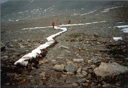
The surficial deposits (glacial deposits, soils, paleolacustrine sediments) and rock outcrops in the Dry Valleys contain unique geomorphological evidence of past environments, and many may be undisturbed for millions of years (Prentice et al. 1998). Desert pavements�which can be destroyed by people walking across them�protect many of these fragile surfaces from the wind.
A wide range of soil types and textures exist in the Dry Valleys. Fine clay soils are susceptible to disturbance, whereas coarse-grained deposits are less likely to be disturbed. Because of the delicate nature of the surficial deposits and outcrops in the Dry Valleys, foot travel is the only permitted mode of travel along the ice-free surface. Typically, researchers walk to study sites for sample and data collection, as well as for instrument installation and maintenance. Alternative modes of travel restricted to the lake ice cover include snowmobiles and all-terrain vehicles (ATVs).
Streambeds are also extremely susceptible to damage from surface traffic. Walking in a stream channel can disrupt microbial mats and fine sediments. Streambed microbial mats and mosses are inconspicuous and easily trampled. Coarser sediments in the deltaic regions near the stream inflows to the lakes are also susceptible to disturbance by surface travel. These impacts may change stream chemistry and biology, and possibly enhance the flux of sediment and biomass into the lakes.
Many streams have steep banks composed of unconsolidated alluvium at the angle of repose and are susceptible to slumping. Slumping could potentially cause a pulse of sediment to be transported into a stream. Walking in these areas may also cause compaction of hyporheic zones (wetted perimeters of streams), as well as disruption of the salt crusts or veneers that occur on the extreme margins of these wetted zones. Both of these impacts could result in short-term water quality changes in the streams and the lakes they supply.
Lakeshores often provide the path of least resistance when walking. Unfortunately, travel in these zones also tends to destabilize banks and cause slumping of sediment onto the lake ice or into the open moats.
2.2.1 Prevention and Mitigation Recommendations
2.3 Camping
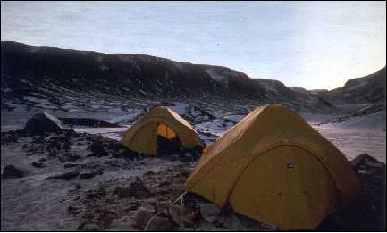
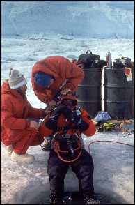
Camping in the Dry Valleys occurs at three general levels: temporary tent camps, seasonal camps, and perennial camps. Temporary tent camps are established for only a few days or weeks of individual field seasons. These camps are usually comprised of less than six individuals and, if managed properly, have very localized impacts to the environment.
Seasonal camps, which are established for many weeks during the austral summer, use tents as well as more substantial structures (e.g., �weather ports�). These camps tend to have larger populations (5�10 individuals) than the temporary tent camps. The expanded populations and longer duration of these camps potentially result in a greater impact on the environment.
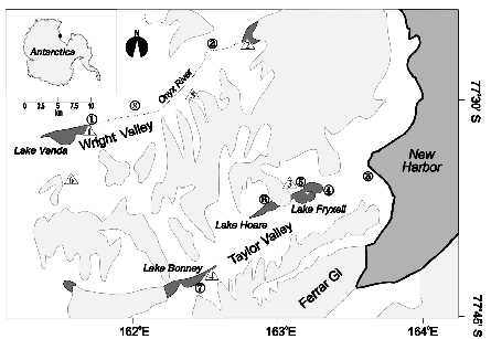
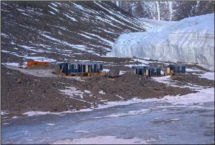
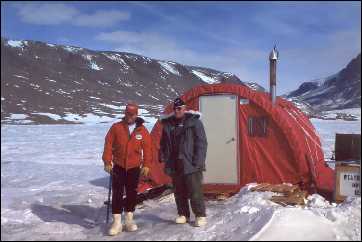
Perennial camps have been established mostly in support of lake and stream research and typically contain a variety of structures (e.g., tents, �Jamesways,� wooden huts). Logistical considerations (e.g., flat ground, water supply) have dictated that the camps be located adjacent to lakes. Presently there are seven perennial camps in the Dry Valleys (Table 3). Camps with the heaviest seasonal personnel traffic (e.g., Lake Hoare Camp) are likely to be the sites of highest impact.
| Map # | Name | Nation | Latitude | Longitude | Built | Activity 1 |
|---|---|---|---|---|---|---|
| 1 | Vanda Camp | N.Z. | 77�31.4' S | 161�40.3' E | 1994/95 | Medium |
| 2 | Lower Wright Hut | N.Z. | 77�26' S | 162�03' E | 1984/85 | Low |
| 3 | New Harbor Camp | U.S. | 77�34.5' S | 163�29.9' E | 1982/83 | Medium |
| 4 | F-6 Camp | U.S. | 77�36.5' S | 163�15.2' E | 1994/95 | Medium |
| 5 | Fryxell Camp | U.S. | 77�36.4' S | 163�07.3' E | 1987/88 | Medium |
| 6 | Hoare Camp | U.S. | 77�37.4' S | 162�54.3' E | 1979/80 | Very High |
| 7 | Bonney Camp | U.S. | 77�42.9' S | 162�33.3' E | 1989/90 | High |
| 8 | Bull Pass Camp | U.S. | 77�31' S | 161�54' E | Uncertain | Low |
| Map # | Name | Nation | Latitude | Longitude | Existence | Activity 1 |
|---|---|---|---|---|---|---|
| 1 | Vanda Camp | N.Z. | 77�31.6' S | 161�40.1' E | 68/69 to 94/95 | Very High |
| 2 | Brownworth Hut | N.Z. | 77�27' S | 162�53' E | 68/69 to 84/85 | Low |
| 3 | Fryxell SSSI Hut | N.Z. | 77�37' S | 163�03' E | 77/78 to 94/95 | Medium |
| 4 | Lake Bonney Hut | U.S. | 77�42.2' S | 162�30.6' E | 62 to 77/78 | Medium |
| 5 | Meserve Camp | U.S. | 77�30.8' S | 162�17.0' E | 68/69 to 82/83 | Medium |
| 6 | Asgaard Hut | N.Z. | 77�35' S | 161�36' E | 68/69 to 94/95 | Low |
| NS 2 | Miers Hut | N.Z. | 78�08' S | 163�50' E | 79 to 95/96 | Low |
When streams are a research focus, it is convenient to set up camps (e.g., F6 Camp at Lake Fryxell) close to stream channels. It may be difficult, however, to identify a stream channel prior to stream flow without consulting a map. Camping in a stream channel would most certainly disrupt the biota in the channel for the same reasons outlined in the section on surface travel. In addition, streamwater chemistry could be altered by unintended contamination from materials used in camp (e.g., fuels, wastewater, reagents).
The following impacts are common to all camp types, with the severity increasing with proximity to the lake and magnitude of the camping activities (i.e., number of people, duration, etc.):
Both the United States and New Zealand programs already take great care to minimize impacts from camping. All wastes are collected and flown back to McMurdo Station for subsequent disposal. Field personnel are trained prior to deployment on various aspects of environmental protection. In order to meet the requirements of the newly promulgated Environmental Protocols to the Antarctic Treaty, the New Zealand Program recently removed the old Lake Vanda camp which had been in place for many years and put considerable effort into the remediation of gray-water contamination and general site cleanup.
The following suggestions will augment the procedures already followed by the United States and New Zealand programs.
Basin-specific activities include those in support of research on climate, glaciers, streams, soils, and local geology and geomorphology.
3.1 Glaciers
Glaciological research activities include measurements of the movement, mass, and energy balance of glaciers and often employ remote sensing techniques. Study of glaciers typically requires travel using skis or crampons and ice axes, the use of generators, sampling of snow and ice, and occasionally necessitates camping on glacial surfaces. The activity likely to have the greatest impact is the use of power equipment (e.g., generators, ice drills, chainsaws) which results in carbon emissions and may lead to spills of fuel and hydraulic fluids. Carbon emissions, and contaminants in general, may enhance ablation and melt on the glaciers, depending on the amount incorporated into snow and ice. Minor contamination may occur from metal crampons and metal snow shovels used to dig snow pits. Activities associated with camping on glacial ice will have impacts similar to those previously described.
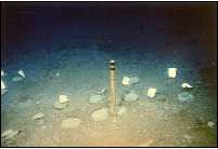
Mass-balance studies often include the installation of bamboo measurement poles and the digging of snow pits. In addition to possible leakage of fuels and oils from power equipment, organic matter contamination from the bamboo poles may also occur.
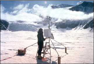
The establishment of meteorological stations on glaciers requires drilling holes with power drills and installing 4� x 4� timbers to support semipermanent, battery powered instrumentation. Significant potential impacts include leakage of drill fuels and chemical contamination from the timbers.
Studies of glaciers occasionally require tunneling into the base for significant distances (e.g., 30 m) using gas-powered chainsaws as well as the installation of metal screws and instrumentation into the ice. These activities could potentially influence chemical and isotopic signatures of the ice and, in turn, the streams and lakes fed by any particular glacier.
3.1.1 Prevention and Mitigation Recommendations
3.2 Streams and Stream Margins
Human activities associated with conducting stream research have substantial potential for impacting Dry Valley lakes. These activities have both temporal and spatial components, which are largely determined by the proximity of stream activities to the lakes.
The following discussion is organized as four different categories of research activities: stream gauging, tracer experiments, stream manipulations, and biomass removal. Included are recommendations to minimize or eliminate impacts on streams and lakes where possible.
The measurement of stream flow is critical to understanding the input of water and nutrients to the Dry Valley lakes. In order to measure stream flow, a gauging station is typically set up at a site in which the flow is constrained either by a natural feature of the channel or by a structure such as a weir or flume. Weirs trap sediment in pools which develop behind them, and these pools may eventually fill-in. A flume, on the other hand, allows for transport of sediment at its base, which mimics the natural movement of sediments in stream flow. Flumes are typically used to measure flow at stream sites in the Dry Valleys. Flume construction results in substantial localized site disturbance, including the filling and placement of sandbags. There are also effects from the disruption of soils associated with data retrieval in subsequent years.
In order to quantify the rates of hydrologic and biogeochemical processes for longer streams, tracer experiments have been conducted using conservative and reactive solutes. For example, two tracer experiments were conducted in the Lake Fryxell basin, one in Huey Creek in 1992 and another in Green Creek in 1995. The solutes that were used as conservative tracers included inorganic anions (Cl - , Br - ) or cations (Na + , Li + ), which are naturally present in the streamwater. Tracer solutions were pumped into the streams for a given time period, and then the tracer concentrations were monitored as a function of time at downstream sites. Similarly, reactive species (such as N and P) have been added to the streams, and the loss of these nutrients at downstream sites is used to quantify nutrient uptake by stream biota.
The design parameters for tracer experiments include target solute concentrations in the stream as well as the duration of the injection and sampling period. Potential impacts from tracer experiments include the increased flux of conservative or reactive solutes to the lakes and the effects of increased streamside trampling during the period of the experiment. In addition to potential increases in solute concentrations in the receiving lake, the use of tracers could change the isotopic ratios of the solute in the lake, limiting the use of the solute for geochemical isotopic studies. Additionally, nutrient additions (e.g., N and P) have the potential to stimulate microbial growth in both streams and receiving lakes.
The Dry Valley streams typically flow through unconsolidated alluvium and episodes of significant sediment deposition are associated with high stream flows. These episodes may change the relative distribution of flow in the stream network. In order to better understand the response of stream ecosystems to longer periods of drying and wetting, the MCM-LTER project initiated a long-term experiment to study the distribution of flow at a location where a channel splits (one stream site in the Lake Fryxell Basin). For the first years of the experiment, the reach with the renewed flow had higher solute concentrations because salts, such as marine aerosols, that had accumulated in the dry channel dissolved into the stream water. Thus, a potential short-term impact of stream manipulations may be an increase in solute flux to the lake.
To study the biota of the streams, samples of microbial mats and mosses are taken from different habitats within the stream channels. The typical sample size is on the order of 1�10 cm 2 of algal mat or 1�10 g of sediment material. On the scale of a stream, which has established microbial mats for several kilometers, this biomass removal is likely to be relatively insignificant in terms of overall ecosystem function. There are some streams, however, where the biota is very sparse (e.g., streams flowing along the base of a glacier in which microbial mats occur only in the delta near the outlet to the lake).
3.2.1 Prevention and Mitigation Recommendations
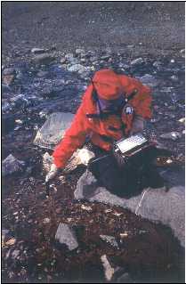
3.3 Soils and Surficial Deposits
Compared to the potential impacts on Dry Valley lakes from glacier and stream research activities, the potential impacts of geological and soil research activities on the lakes are likely to be minor. Lake level fluctuations are an important consideration, however, as many lakebeds are former soil sites and vice versa. When planning geological and soil research activities, impact assessment should include a temporal component if there is potential for the site to be submerged.
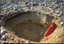
Geological and soil research may entail blasting on a small scale, digging soil pits, scraping natural exposures, and coring. Blasting currently requires strict adherence to environmental assessment guidelines. Digging soil pits (usually performed with hand tools) is generally restricted to a maximum area of 1 m 2 and a maximum depth of 1 m. Sampling natural exposures may require scraping surfaces with a tool (e.g., rock hammer, ice axe). Mechanical coring devices may also be used for sampling ground ice.
Investigations of soil biota require removing surface soil samples. This is generally considered a low impact activity, especially with regard to lake impacts (Vincent 1996). Foot travel in the area of research probably has more of an environmental impact than sample removal.
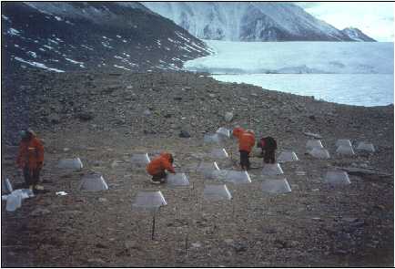
Some long-term experiments manipulate surface soil conditions and record biological responses. These experiments are generally confined to 1 m 2 plots and artificially augment the soil with known amounts of carbon, water, and heat. There is very little data available on the impact of these experiments on surface or groundwater flow.
3.3.1 Prevention and Mitigation Recommendations
This section explores lake research activities in the Dry Valleys and is divided into four components: (1) ice covers, (2) water column, (3) benthos, and (4) diving and remotely-operated vehicles. The potential impacts of research activities and recommendations for preventing or minimizing future impacts are discussed for each component.
4.1 Ice Covers
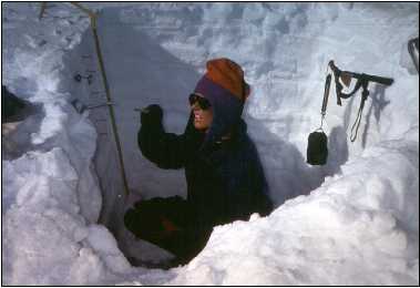
During the austral summer field season, the ice covers of the Dry Valley lakes are directly impacted by human activities. The covers provide a platform for transportation and research activities. Ice covers consist of two elements: (1) the perennial ice that is of long-term duration and varies from 2.8�19 m in thickness depending on the lake, and (2) the 1�2 m thick moat ice which typically melts and refreezes annually. During the course of the summer season, the temperature of the perennial ice rises to 0 o C, and the permeability of the ice barrier increases. During most summers, the moat ice will melt out and expose the littoral water to the atmosphere. Therefore, the impact of research activities on the ice covers can vary depending on the location and timing of the disturbance relative to the seasonal and interannual progression of ice properties. Importantly, impacts to the ice can also affect the water column and benthos. When the lake ice is isothermal, for example, a fuel spill on the ice surface might readily penetrate the ice and mix with the water column below.
Activities that can potentially impact lake ice include: (1) walking or driving across the ice, (2) placing structures on the ice, (3) operating power equipment, (4) excavating, and (5) sampling through the ice cover. Surface transport (flying, driving, and walking) across ice covers increases the potential for dropping debris on the ice. Driving ATVs or snowmobiles across lake ice can destroy surface features, especially in late summer when surface melt features (e.g., ablation ridges) appear. Motorized vehicles also introduce exhaust and the potential for fluid spills and leakage. Aircraft landing on or near the ice locally alter surface characteristics and redistribute debris and particulates. Aircraft also increase the potential for contamination by hydrocarbons (e.g., hydraulic fluids, exhaust, fuel).
Structures (e.g., "weather ports," storage and instrument boxes) placed on the ice cover impact the lake by shading and changing the physical structure of the ice. Specific impacts include changing albedo, sublimation, precipitation, and aeolian deposition processes. Structures may also contribute contaminants to the ice.
Operating powered equipment on the lake ice increases the potential for contaminating the ice with debris and chemicals (e.g., glycol, metals, oil, fuel, and exhaust). Fueling equipment on the ice increases the probability of a substantial introduction of chemicals on the ice covers and possibly into the lake water as well.
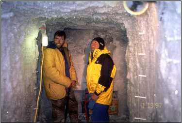
Ice excavation activities include removing moat ice for camp water use, obtaining ice cores for scientific purposes, creating observation holes, and drilling or melting holes to access the lake. Removing ice alters the ice morphology and locally changes processes including radiative transfer, particulate and debris deposition, sediment transport into the lake, and gas exchange. The process of excavating ice also potentially introduces debris and metal contaminants into the ice itself. Thus on a scale of several meters, ice excavation changes the ice chemistry, physical stratigraphy, and the distribution of resident microbial consortia.
The ice cover is the physical platform from which the water column and benthos are accessed for sampling purposes. Activities (e.g., drilling, melting) associated with accessing these environments affect the ice by first compromising the natural physical structure as described above. Further, sampling the water column and benthos can lead to the introduction of foreign materials onto or into the ice (e.g., contaminants introduced from drills and hole-melting equipment, saline bottom water, and sediment from cores brought to the surface).
4.1.1 Prevention and Mitigation Recommendations
4.2 Water Column
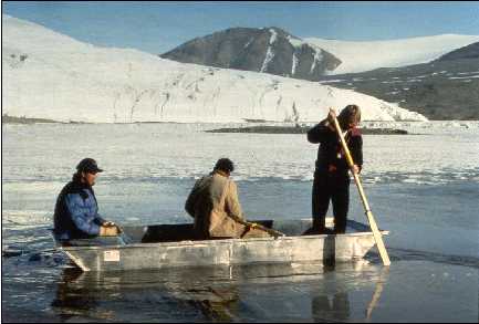
Research activities that currently take place on the lakes include the following: (1) moat associated activities, (2) use of monitoring equipment in the water column, (3) water and sediment collection, and (4) in situ profiling measurements of conductivity, oxygen, and underwater light. These activities will have varying levels of impact on the biological, chemical, and physical properties of the lakes.
Research-related activities on lake moats (either when the moat is frozen or thawed) can impact (e.g., fuel spills, chemically imprinted dust deposition) the moat water that forms after ice melt. As mentioned previously, there are mechanisms resulting in hydrological interchange between the moat water and the lake water proper. Thus, impacts to the moats also have the potential of affecting the lake water. For example, a fuel spill in the moat may eventually make its way beneath the perennial lake ice cover impacting the water column and sediments of the lake.
Use of monitoring equipment (e.g., light sensors, thermistor strings, sediment traps, automated primary production systems, current meters) provides colonization surfaces and potential metal contamination of lake water. Sediment traps may contain chemically toxic fixatives. Disturbance to hydrodynamic stability caused by motion produced by diving, deployment of instruments (e.g., profiling instruments, sampling bottles, ROVs, drilling rigs, enclosures) can disrupt the strongly stratified (e.g., salinity, oxygen and other gas concentrations, temperature) character of some water columns.

Routine sampling which requires the use of drills and melting devices has the potential to cause metal contamination. Glycol leaks and spills can occur during the melting process. Metal contamination may also result from the use of cables and sampling devices. Excess water from sampling should not be returned to the water column or deposited on the ice surface, but instead should be added to gray water waste collection at a permanent camp. During routine limnological sampling of the Dry Valley lakes, biological cross-contamination between lakes may occur because the same monitoring equipment (e.g., CTD, light meter) is used for all lakes.
At present, the only radioisotope used in situ is 14C-sodium bicarbonate for assessing primary productivity. All other radiochemical assays are conducted in field laboratories or at McMurdo Station. A number of other radioisotopes and stable isotopes have been used in the past including 3H, 34I, 15N, 33P, and 35S. The accidental release of 14C has been documented in lakes Bonney and Fryxell and is believed to have occurred in Lake Vanda as well.
The spatial extent of localized water column disturbances and their dispersion time scales need to be considered. Little is known about the propagation of water column disturbances and their potential for persistence. Beginning with the 1996�97 austral summer season, sampling site locations utilized by the MCM-LTER have been documented using a GPS. The level of seasonal sampling activity on a given lake, however, is not available in a centralized or easily accessible form.
4.2.1 Prevention and Mitigation Recommendations
Activities associated with research on the benthos of Dry Valley lakes include the following: (1) making access holes through ice covers, (2) sample collection from the ice surface, and (3) sample collection by divers. Experiments are also deployed on the lake bottoms, usually by divers.
In order to conduct research activities associated with the benthos, access holes with various sized openings must be made in the perennial ice. Potential impacts from these holes include: (1) changes in the optical properties of the ice affecting the quality and quantity of light reaching the water column and benthos, (2) burial of underlying benthos by ice cover sediment released during hole making, (3) warming of surface water during the hole melting process, (4) disruption of water column surface during hydrologic connection, and (5) atmospheric exchange during the period that the hole is kept open.
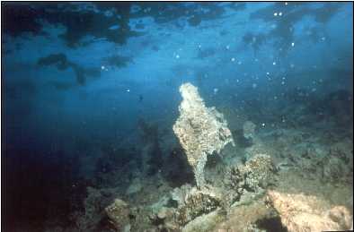
Current benthic research activities involve a range of techniques including use of a variety of remotely-operated sediment coring devices and ROVs as well as direct collection of samples by SCUBA divers. Remotely-operated sediment coring devices include Ekman grab samplers and piston corers. These require a hole up to 0.5 m diameter to be made through the ice. Impacts on the physical structure of the water column are likely to be small due to the low profile of the instruments. Localized physical disturbances by sampling equipment, divers, and ROVs may disrupt, at least temporarily, the stable benthic boundary layers. Disturbance of benthic communities can affect fluxes of organic and inorganic nutrients from sediments to the water column.

Coring often results in the disruption of benthic communities, extending to diameters considerably larger than the sampler size as a result of sampling device impact and extraction from the sediments. In addition, contamination of water columns and the ice surface may also occur during retrieval of the core since most corers leak fine sediments.
4.3.1 Prevention and Mitigation Recommendations
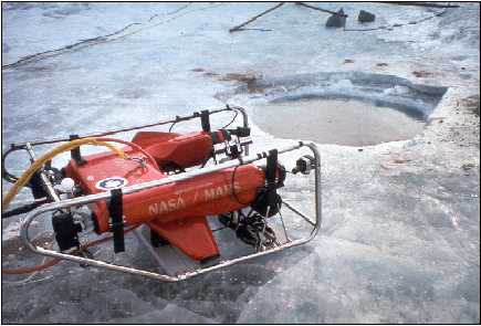
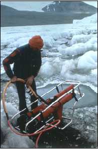
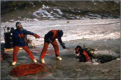
Research diving and the use of ROVs potentially impact lake ice covers, water columns, and benthos and so warrant a separate discussion. Diving is performed in the Dry Valley lakes mostly in support of benthic research, but some water column research has also been performed this way. Certain research (e.g., sample collection and experimentation away from the access hole) would be extremely difficult without diving. Remotely-operated vehicles have the capability to stay submerged for extended time periods and can travel much greater distances than tethered divers. These vehicles have only been used in Lake Hoare during two field seasons (1986�87 and 1992�93).
Both diving and ROV use require the creation of relatively large (~1.5 m diameter) holes in the ice cover. The impacts of creating these holes should be similar to those for other water column and benthic sampling as previously mentioned, but on a slightly larger scale. Additional concerns associated with research diving include physical disruption of the water column by diver motion and rising bubble plumes, introduction of diver-exhaled gases to the ice cover and water column, physical disruption of the benthos, and biological cross-contamination between the lakes.
The use of ROVs has greater potential for disturbing the water column and the benthos than surface-deployed samplers or divers. These vehicles use mechanical propulsion systems which stir up the water column. Further, ROVs can be in the water for long periods of time, use umbilical cords which can disturb the benthos, and are difficult to control, thereby creating the probability of benthos destruction if operated near the bottom.
The most thorough consideration to date of environmental impacts of research activities on Dry Valley lakes focused on the potential effects of diving (Kepner et al. 1999). Within the constraints of this study, no significant changes in the water column properties of Lake Fryxell were found as a result of diving activity. Restrictions on diving may limit, or even prevent, some types of investigations within the lakes. Based upon the study of Kepner et al. (1999), the restriction of SCUBA diving as a bona fide research tool in the lakes is in most cases not justified. Whereas diving in the Dry Valley lakes has been classified (Vincent 1996) as having a relatively moderate to unacceptably high level of environmental impact, Kepner et al. (1999) proposed that diving is best classified, both spatially and temporally, as a low to moderate impact activity.
Deploying a remotely-operated
vehicle (ROV).
4.4.1 Prevention and Mitigation Recommendations
The McMurdo Dry Valleys are a largely pristine environment and have enormous scientific value for regional and global scientific studies. The Dry Valley lakes represent a significant scientific resource in that they are among the few natural waters on Earth that are only minimally impacted by human activities. It is important that all people visiting and working in the McMurdo Dry Valleys recognize the extraordinary value of these lakes. Human actions in the field should be in concert with the recognized value. Thus, it is incumbent upon the NSF to provide training so that all members of field parties and visitors recognize and minimize the potential environmental impact caused by research activities.
It is recommended that all individuals (scientists, support personnel, visitors, and tourists) entering the Dry Valleys be required to take an orientation course emphasizing the uniqueness and the significance of the lakes and highlighting strategies for reducing human impacts on them. At a minimum, this course should include: (1) a narrated video on the geological and environmental setting; (2) an overview of the physics, chemistry, and biology of the lakes; (3) an orientation lecture at McMurdo Station emphasizing environmental awareness; and (4) review of the code of conduct providing guidelines for fieldwork on the lakes and for living and traveling in lake basins.
Within this report are numerous recommendations related to the prevention and mitigation of potentially adverse environmental impacts to the Dry Valley lakes. The prevention of negative impacts to the lakes is obviously the preferred alternative. To this end, the recommendations concerning helicopter traffic and operations, surface travel, camping, and research activities specific to glaciers, stream, soils, and lakes should be adopted and implemented by the NSF.
The workshop participants recognized that there are also a number of areas where additional scientific information is required to assess the impacts of human activity on the Dry Valley lakes. Further evaluation of the impacts of ice removal, water column and benthic sampling, and SCUBA diving would be useful. To assess the impact of a chemical spill at some distance from a lake, it is necessary to know whether there is shallow groundwater movement in the area. Systematic studies of groundwater in the Dry Valleys could prove valuable in determining the potential for pollutant transport to the lakes. Additional research is necessary to better understand the hydrological connections among the streams, moats and lakes, as well as the circulation patterns within the lakes. Development of a soil map indicating areas near streams and lakes that are especially vulnerable to physical disruption (e.g., due to helicopter landings and surface travel) is recommended. Quantitative studies documenting the input of pollutants from helicopters, vehicles, and generators to the Dry Valley environment would be useful in comparing human-induced change with the natural background levels.
Current reporting of research activities in the Dry Valleys is inadequate. As indicated several times in this report, it is strongly recommended that sampling locations be determined (using a GPS), that activity levels be measured, and that locations be adequately documented. This information should be recorded using a GIS and made available to all those visiting and working in the region. Further, these records should be maintained into the future. The scientific activities in the McMurdo Dry Valleys� past, present, and planned for the future� should be made available on a website database similar to the one developed for the current MCM-LTER project with linkages to other relevant sites (e.g., Scientific Committee on Antarctic Research [SCAR] and British Antarctic Survey [BAS]).

Another issue for present and future scientific activities in the Dry Valley lakes involves "incompatible science," or conflicting scientific activities of different disciplines. With the advent of the MCM-LTER program, many different activities are simultaneously occurring on and around the lakes. Although this interdisciplinary approach to the study of ecosystem dynamics is fundamental to understanding these systems, incompatible scientific activities are a potential problem. The review of proposals for research in the Dry Valleys should consider the impact of the proposed research (e.g., stream research) on other types of research (e.g., geological studies).
Finally, serious consideration should be given to incorporating the recommendations of this report into a management plan for the Dry Valleys. The Environmental Protocols of the Antarctic Treaty, which came into force in 1998, are an important mandate to give international protection to the Dry Valleys and other regions in Antarctica. The Protocols offer an ideal forum to develop a long-term management strategy for the Dry Valleys incorporating this report�s recommendations. In particular, Article 4 of the Environmental Protocol describes Antarctic Specially Managed Areas (ASMA) as �any area, including any marine area, where activities are being conducted or in the future may be conducted, may be designated as an Antarctic Specially Managed Area to assist in the planning and coordination of activities, avoid possible conflicts, improve cooperation between Parties or minimize environmental impacts.�
Designation of the entire McMurdo Dry Valley region as an ASMA would require that a formal management plan be developed. An ASMA is the logical next step in the ongoing international discussions concerning the impacts of human activities in the Dry Valleys. This and previous international workshop reports (Wharton 1992; Vincent 1996) provide much of the rationale and scientific basis for pursuing the establishment of a McMurdo Dry Valleys ASMA. It is recommended that NSF take the lead in developing an ASMA designation for the McMurdo Dry Valleys in cooperation with Antarctica New Zealand and other interested parties.

Alger, A.S., Knight, D.M., Spaulding, S.A., Shupe, G.H., Welch, A., Edwards, R., Andrews, E.D., and House, H.R. 1997. Ecological processes in cold desert ecosystem; the abundance and species distribution of algal mats in glacial meltwater streams in Taylor Valley, Antarctica. Occasional Paper - Colorado University, Institute of Arctic and Alpine Research 51: 108.
Andersen, D.T., McKay, C.P., and Wharton, R.A., Jr. 1998. Dissolved gases in perennially ice-covered lakes of the McMurdo Dry Valleys, Antarctica. Antarctic Science 10(2): 124-133.
Bockheim, J.G. 1997. Properties and classification of cold desert soils from Antarctica. Soil Science Society of America Journal 61(1): 224-231.
Campbell, I.B. and Claridge, G.G.C. 1987. Antarctica: soils, weathering processes and environment. Elsevier, Amsterdam, 368 pp.
Campbell, I.B., Claridge, G.G.C., Campbell, D.I., and Balks, M.R. 1998. The soil environments of the McMurdo Dry Valleys, Antarctica. In: J.C. Priscu (Editor), Ecosystem dynamics in a polar desert: the McMurdo Dry Valleys, Antarctica. Antarctic Research Series, Vol. 72, pp. 297-322. American Geophysical Union, Washington, D.C.
Conovitz, P.A., McKnight, D.M., MacDonald, L.H., Fountain, A.G., and House, H.R. 1998. Hydrologic processes influencing streamflow variation in Fryxell Basin, Antarctica. In: J.C. Priscu (Editor), Ecosystem dynamics in a polar desert: the McMurdo Dry Valleys, Antarctica. Antarctic Research Series, Vol. 72, pp. 93-108. American Geophysical Union, Washington, D.C.
Doran, P.T., Wharton, R.A., Jr., and Lyons, W.B. 1994. Paleolimnology of the McMurdo Dry Valleys, Antarctica. Journal of Paleolimnology 10(2): 85-114.
Fountain, A.G., Dana, G.L., Lewis, K.J., Vaughn, B.H., and McKnight, D. 1998. Glaciers of the McMurdo dry valleys, southern Victoria Land, Antarctica. In: J.C. Priscu (Editor), Ecosystem dynamics in a polar desert; the McMurdo Dry Valleys, Antarctica. Antarctic Research Series, Vol. 72, pp. 65-75. American Geophysical Union, Washington, D.C.
Freckman, D.W. and Virginia, R.A. 1998. Soil biodiversity and community structure in the McMurdo Dry Valleys, Antarctica. In: J.C. Priscu (Editor), Ecosystem dynamics in a polar desert; the McMurdo Dry Valleys, Antarctica. Antarctic Research Series, Vol. 72, pp. 323-335. American Geophysical Union, Washington, D.C.
Goldman, C.R., Mason, D.T., and Hobbie, J.E. 1967. Two Antarctic desert lakes. Limnology and Oceanography 12: 295-310.
Green, W.J. and Friedmann, E.I. (Editors) 1993. Physical and biogeochemical processes in Antarctic lakes. Antarctic Research Series, Vol. 59. American Geophysical Union, Washington, D.C., xi, 216 pp.
Hawes, I. and Schwarz, A.-M. 1999. Photosynthesis in an extreme shade environment: benthic microbial mats from Lake Hoare, a permanently ice-covered Antarctic lake. Journal of Phycology 35: 448-459.
Howard-Williams, C., Schwarz, A.-M., Hawes, I., and Priscu, J.C. 1998. Optical properties of the McMurdo Dry Valley lakes. In: J.C. Priscu (Editor), Ecosystem dynamics in a polar desert; the McMurdo Dry Valleys, Antarctica. Antarctic Research Series, Vol. 72, pp. 153-188. American Geophysical Union, Washington, D.C.
James, T.S. and Ivins, E.R. 1998. Predictions of Antarctic crustal motions driven by present-day ice sheet evolution and by isostatic memory of the Last Glacial Maximum. Journal of Geophysical Research-Solid Earth 103(B3): 4993-5017.
Kepner, R., Kortyna, A., Wharton, R., Doran, P., Andersen, D., and E. Roberts. 1999. Effects of research diving on a stratified antarctic lake. Water Research, in press.
Kepner, R.L., Wharton, R.A., and Suttle, C.A. 1998. Viruses in Antarctic lakes. Limnology and Oceanography 43(7): 1754-1761.
Laybourn-Parry, J., James, M.R., McKnight, D., Priscu, J., Spaulding, S., and Shiel, R. 1997. The microbial plankton of Lake Fryxell, southern Victoria Land, Antarctica. Polar Biology 17(1): 54-61.
Lyons, W.B, Welch, K.A., Neumann, K., Toxey, J.K., McArthur, R., McKnight, D.M., and Moorhead, D. 1998. Geochemical linkages among glaciers, streams and lakes within the Taylor Valley, Antarctica. In: J.C. Priscu (Editor), Ecosystem dynamics in a polar desert: the McMurdo Dry Valleys, Antarctica. Antarctic Research Series, Vol. 72, pp. 77-92. American Geophysical Union, Washington, D.C.
McKay, C.P., Clow, G.D., Andersen, D.T., and Wharton, R.A. 1994. Light Transmission and Reflection in Perennially Ice-Covered Lake Hoare, Antarctica. Journal of Geophysical Research-Oceans 99(C10): 20427-20444.
McKnight, D.M. and Andrews, E.D. 1993. Hydrologic and geochemical processes at the stream-lake interface in a permanently ice-covered lake in the McMurdo Dry Valleys, Antarctica. Verhandlungen - Internationale Vereinigung fuer Theoretische und Angewandte Limnologie - Proceedings - International Association of Theoretical and Applied Limnology 25(2): 957-959.
Miller, L.G. and Aiken, G.R. 1996. Effects of glacial meltwater inflows and moat freezing on mixing in an ice-covered antarctic lake as interpreted from stable isotope and tritium distributions. Limnology and Oceanography 41(5): 966-976.
Parker, B.C. (Editor) 1972. Conservation Problems in Antarctica. Virginia Polytechnic Institute and State University, Blacksburg, Virginia. 356 pp.
Parker, B.C. and Holliman, M.C. (Editors) 1978. Environmental Impact in Antarctica. Virginia Polytechnic Institute and State University, Blacksburg, Virginia. 390 pp.
Parker, B.C., Seaburg, K.G., Cathey, D.D., and Allnutt, F.T.C. 1982. Comparative ecology of plankton communities in seven Antarctic oasis lakes. Journal of Plankton Research, 4: 271-286.
Prentice, M.L., Kleman, J., and Stroeven, A.P. 1998. The composite glacial erosional landscape of the northern McMurdo dry valleys; implications for Antarctic Tertiary glacial history. In: J.C. Priscu (Editor), Ecosystem dynamics in a polar desert; the McMurdo Dry Valleys, Antarctica. Antarctic Research Series, Vol. 72, pp. 1-38. American Geophysical Union, Washington, D.C.
Priscu, J.C. 1995. Phytoplankton Nutrient Deficiency in Lakes of the McMurdo Dry Valleys, Antarctica. Freshwater Biology 34(2): 215-227.
Priscu, J.C. (Editor) 1998. Ecosystem dynamics in a polar desert; the McMurdo Dry Valleys, Antarctica. Antarctic Research Series, Vol. 72. American Geophysical Union, Washington, D.C. 369 pp.
Spaulding, S.A., McKnight, D.M., Smith, R.L., and Dufford, R. 1994. Phytoplankton Population-Dynamics in Perennially Ice-Covered Lake Fryxell, Antarctica. Journal of Plankton Research 16(5): 527-541.
Squyres, S.W., Andersen, D.W., Nedell, S.S., and R.A. Wharton, Jr. 1991. Lake Hoare, Antarctica : Sedimentation through thick perennial ice cover. Sedimentology 38: 363-379.
Tyler, S.W., Cook, P.G., Butt, A.Z., Thomas, J.M., Doran, P.T., and Lyons, W.B. 1998. Evidence of deep circulation in two perennially ice-covered Antarctic lakes. Limnology and Oceanography 43(4): 625-635.
Vincent, W.F. 1981. Production strategies in Antarctic inland waters: Phytoplankton ecophysiology in a permanently ice-covered lake. Ecology 62(5): 1215-1224.
Vincent, W.F. 1988. Microbial ecosystems of Antarctica. Cambridge University Press, 291 pp.
Vincent, W.F. and Howard-Williams, C. 1989. Microbial Communities in Southern Victoria Land Streams (Antarctica). 2. The Effects of Low-Temperature. Hydrobiologia 172: 39-49.
Vincent, W.F. (Editor) 1996. Environmental Management of a Cold Desert Ecosystem: the McMurdo Dry Valleys. Desert Research Institute, Special Publication, 57 pp.
Vincent, W.F., Rae, R., Laurion, I., Howard-Williams, C., and Priscu, J.C. 1998. Transparency of Antarctic ice-covered lakes to solar UV radiation. Limnology and Oceanography 43(4): 618-624.
Wharton, R.A., Jr., Parker, B.C., and Simmons, G.M., Jr. 1983. Distribution, species composition and morphology of algal mats in Antarctic dry valley lakes. Phycologia 22(4): 355.
Wharton, R.A., Jr., McKay, C.P., Parker, B.C., and Simmons, G.M., Jr. 1986. Oxygen budget of a perennially ice-covered Antarctic dry valley lake. Limnology and Oceanography 31: 437-443.
Wharton, R.A., Jr., McKay, C.P., Mancinelli, R.L., and Simmons, G.M., Jr. 1987. Perennial N2 supersaturation in an Antarctic lake. Nature 325: 343-345.
Wharton, R.A. 1992. The McMurdo Dry Valleys: A cold desert ecosystem. Desert Research Institute, Special Publication, 51 pp.
Wharton, R.A., McKay, C.P., Clow, G.D., and Andersen, D.T. 1993. Perennial ice covers and their influence on Antarctic lake ecosystems. In: W. Green and E.I. Friedmann (Editors), Physical and Biogeochemical Processes in Antarctic Lakes. Antarctic Research Series, American Geophysical Union, Washington, D.C., pp. 53- 70.
Edward E. Adams, Civil Engineering, Montana State University, 205 Cobleigh Hall, Bozeman, MT 59717, USA. Phone: (406) 994-6122, Fax: (406) 994-6105. E-mail: eda@ce.montana.edu
Carl J. Bowser, Geology and Geophysics, University of Wisconsin, 1215 W. Dayton St., Madison, WI 53706, USA. Phone: (608) 262-8955, Fax: (608) 262-0693. E-mail: bowser@geology.wisc.edu
Susan Brantley, Geosciences, Pennsylvania State University, 239 Deike Bldg., University Park, PA 16802, USA. Phone: (814) 863-1739, Fax: (814) 863-1395. E-mail: brantley@geosc.psu.edu
Melody B. Burkins, Environmental Studies, Dartmouth College, 6182 Steel Hall, Hanover, NH 03755, USA. Phone: (603) 646-1612, Fax: (603) 646-1682. E-mail: melody.burkins@dartmouth.edu
R. Richard Costello, Desert Research Institute, 1729 Glenview Dr., Las Vegas, NV 89134, USA. Phone: (702) 876-2258, Fax: (702) 876-8806. E-mail: costello@dri.edu
Gayle L. Dana, Division of Hydrologic Sciences, Desert Research Institute, 2215 Raggio Pkwy., Reno, NV 89512, USA. Phone: (775) 674-7538, Fax: (775) 673-7485. E-mail: gdana@dri.edu
Peter Doran, Earth and Environmental Sciences (MC 186), University of Illinois at Chicago, 845 W. Taylor, Room 2460, Chicago, IL 60607, USA. Phone: (312) 413-7275, Fax: (312) 413-2279. E-mail: pdoran@uic.edu
Cynan Ellis-Evans, Terrestrial and Freshwater Life Sciences Division, British Antarctic Survey, High Cross Site, Madingley Road, Cambridge, CB3 OET, United Kingdom. Phone: 0044-1223-221555, Fax: 0044-1223-362616. E-mail: jcel@pcmail.nerc-bas.ac.uk
Christian H. Fritsen, Division of Earth and Ecosystem Sciences, Desert Research Institute, 2215 Raggio Pkwy., Reno, NV 89512, USA. Phone: (775) 673-7487, Fax: (775) 673-7485. E-mail: cfritsen@dri.edu
Charles Goldman, Division of Environmental Studies, University of California, Davis, 3104D Wickson Hall, Davis, CA 95616, USA. Phone: (530) 752-1557, Fax: (530) 752-3350. E-mail: crgoldman@ucdavis.edu
William Green, School of Interdisciplinary Studies, Miami University (Ohio), Oxford, OH 45056, USA. Phone: (513) 523-3401. E-mail: greenwj@muohio.edu
Brenda L. Hall, Institute for Quaternary Studies and Department of Geological Sciences, University of Maine, 5790 Bryand Global Science Center, Orono, ME 04469-5790, USA. Phone: (207) 581-2191, Fax: (207) 581-1203. E-mail: brendah@maine.edu
Ian Hawes, National Institute for Water and Atmospheric Research (Ltd.), 10 Kyle St., Christchurch, New Zealand. Phone: +64 3 348 8987, Fax: +64 3 348 5548. E-mail: i.hawes@niwa.cri.nz
Clive Howard-Williams, National Institute for Water and Atmospheric Research (Ltd.), 10 Kyle St., Christchurch, New Zealand. Phone: +64 3 348 8987, Fax: +64 3 348 5548. E-mail: c.howard-williams@niwa.cri.nz
Raymond Kepner, School of Science, Marist College, 101 Donnelly Hall, 290 North Road, Poughkeepsie, NY 12601-1387, USA. Phone: (914) 575-3000 (ext. 2285), Fax: (914) 575-3180. E-mail: ray.kepner@marist.edu
Andrew Kortyna, Physics, Bates College, 44 Campus Ave., Lewiston, ME 04282, USA. Phone: (207) 786-6324. E-mail: akortyna@abacus.bates.edu
Steven T. Kottmeier, Antarctic Support Associates, 61 Inverness Drive East, Suite 300, Englewood, CO 80112, USA. Phone: (303) 643-0108, Fax: (303) 790-9130. E-mail: kottmest.asa@asa.org
Johanna Laybourn-Parry, Division Environmental Science, School of Biological Sciences, University of Nottingham, Sutton Bonington, Loughborough, Leics. LE12 5RD, United Kingdom. Phone: + 44 115 951 6262, Fax: +44 115 951 6261. E-mail: j.laybourn-parry@nottingham.ac.uk
W. Berry Lyons, Geology, University of Alabama, Tuscaloosa, AL 35487-0338, USA. Phone: (205) 348-0583, Fax: (205) 348-0818. E-mail: blyons@ua1vm.ua.edu
David R. Marchant, Earth Sciences, Boston University, 685 Commonwealth Ave., Boston, MA 02215, USA. Phone: (617) 353-3236, Fax: (617) 353-3290. E-mail: marchant@bu.edu
Roberta L. Marinelli, Antarctic Biology and Medicine, National Science Foundation, Office of Polar Programs, 4201 Wilson Blvd., Arlington, VA 22230, USA. Phone: (703) 306-1033, Fax: (703) 306-0139. E-mail: rmarinel@nsf.gov
Diane M. McKnight, Civil, Environmental, and Architectural Engineering, Institute of Arctic and Alpine Research, 1560 30th St., Boulder, CO 80309, USA. Phone: (303) 492-4687, Fax: (303) 492-6388. E-mail: diane.mcknight@colorado.edu
Heidi M. Nepf, Civil and Environmental Engineering, Massachusetts Institute of Technology, 48-425 MIT, Cambridge, MA 02139, USA. Phone: (617) 253-8622, Fax: (617) 258-7009. E-mail: hmnepf@mit.edu
Andy Parsons, Natural Resource Ecology Laboratory (NREL), Colorado State University, Fort Collins, CO 80523-1499, USA. Phone: (970) 491-1098, Fax: (970) 491-1965. E-mail: andy@nrel.colostate.edu
Wayne H. Pollard, Department of Geography, McGill University, 805 Sherbrooke St. W., Montreal, QC H3A 2K6, Canada. Phone: (514) 398-4454, Fax: (514) 398-7437. E-mail: pollard@felix.geog.mcgill.ca
John Priscu, Biological Sciences, Montana State University, 310 Lewis Hall, Bozeman, MT 59714, USA. Phone: (406) 994-2360 or 3250, Fax: (406) 994-5863. E-mail: ubijp@terra.oscs.montana.edu
Robert H. Spigel, Civil Engineering, University of Canterbury, Private Bag 4800, Christchurch, New Zealand. Phone: ++64 3 3642 234, Fax: ++64 3 3642 758. E-mail: spigel@cad.canterbury.ac.nz
Amy M. Treonis, Natural Resource Ecology Lab, Colorado State University, Fort Collins, CO 80521, USA. Phone: (970) 491-5262, Fax: (970) 491-1965. E-mail: amy@nrel.colostate.edu
Sergey Verkulich, Polar Geography, Russian Arctic and Antarctic Research Institute, Bering St., 38, St. Petersburg, 199397, Russia. Phone: (812) 352-2246, Fax: (812) 352-2930. E-mail: aaricoop@aari.nw.ru
Warwick F. Vincent, Biologie, Universit� Laval, Ste-Foy, QC G1K 7P4, Canada. Phone: (418) 656-5644, Fax: (418) 656-2043. E-mail: warwick.vincent@bio.ulaval.ca
Mary A. Voytek, WRD, U.S. Geological Survey, MS 430, 12202 Sunrise Valley Dr., Reston, VA 20192, USA. Phone: (703) 648-6894, Fax: (703) 648-5484. E-mail: mavoytek@usgs.gov
Amy K. Ward, Biological Sciences, University of Alabama, PO Box 870206, A122 Bevill, Hackberry Lane, Tuscaloosa, AL 35487, USA. Phone: (205) 348-1796, Fax: (205) 348-1403. E-mail: award@biology.as.ua.edu
Kathy A. Welch, Geology, University of Alabama, 202 Bevill Building, Tuscaloosa, AL 35487-0338, USA. Phone: (205) 348-6427, Fax: (205) 348-0818. E-mail: kwelch@wgs.geo.ua.edu
Robert A. Wharton, Division of Earth and Ecosystem Sciences, Desert Research Institute, 2215 Raggio Pkwy., Reno, NV 89512, USA. Phone: (775) 673-7469, Fax: (775) 673-7485. E-mail: wharton@dri.edu
Craig F. Wolf, Biology, Montana State University, 310 Lewis Hall, Bozeman, MT 59717, USA. Phone: (406) 994-2360, Fax: (406) 994-5863. E-mail: cwolf@montana.edu
Why are the Dry Valleys considered so important by the scientific community? The Dry Valleys ecosystem contains geological and biological features that date back thousands to millions of years. Many of these ancient features could be easily and irreversibly damaged by inadvertent human actions. Unusual communities of microscopic life forms, low biodiversity, simple food webs with limited trophic competition, severe temperature stress, aridity, and nutrient limitations are other characteristics which make the Dry Valleys unique. Research in such systems must always aim to minimize impacts on land, water, and ice to protect them for future generations. This code suggests how you can help to ensure this.
General:
This ancient desert landscape and its biological communities have very little natural ability to recover from disturbance. In your visit to the valleys, strive for "zero impact."
Everything taken into the valleys must be taken out. This also means avoiding the use or dispersal of foreign materials that are difficult to collect and remove; e.g., do not use spray paint to mark rocks; where possible, perform all cutting, sawing, and unpacking inside a hut or tent.
Field camps:
- arrival and setting up
- water, fuel and chemicals
| Front Cover | R. Wharton |
| Page IV | P. Doran |
| Page 3 | R. Wharton |
| Page 8 | G. Dana |
| Page 11 | D. Andersen |
| Page 15 | R. Wharton |
| Page 16 | G. Dana |
| Pages 20-21 | R. Wharton |
| Page 22 | G. Dana |
| Page 23 | R. Wharton |
| Page 24 | G. Dana |
| Page 25 | D. McKnight |
| Page 26 | R. Wharton |
| Page 28 | D. Wall |
| Page 29 | P. Doran |
| Page 30 | R. Wharton |
| Page 32 | D. Andersen |
| Pages 34-35 | D. Andersen |
| Pages 36-37 | R. Wharton |
| Page 39 | R. Wharton |
| Page 41 | G. Dana |